
Modeling Bison Migration
The National Park Service had a problem...
For solutions, they came to YERC.
The National Park Service had a problem.
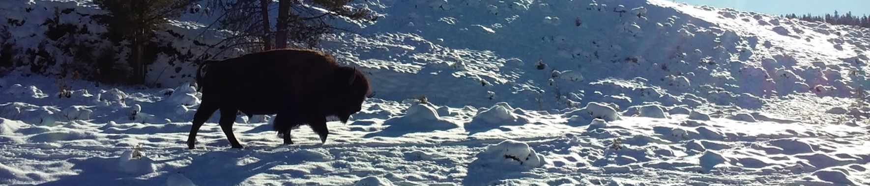
Bison migrating from Yellowstone National Park to lower, drier "winter range" were causing conflicts with the park's neighbors as they potentially carried the risk of disease transmission to domestic livestock, posed a human safety hazard, and caused property damage—one can imagine what a 2,000 pound bull can do to someone's fence, garden, or automobile. Responding to these conflicts by hazing bison back into the park or even culling the herd in turn poses its own risks for the conservation of the species, brought back from a few dozen individuals left in Yellowstone at the end of the 19th Century to over 4,000 head in the park today. And that is to say nothing of the ethical concerns of applying such aggressive management to a wild species, especially by an agency whose own policy urges against intervention in natural processes. One thing was for sure: bison that leave the park in the winter quickly become a national and even international issue resulting in massive media coverage. Yellowstone and its bison needed help.
For effective management that both conserves bison and other park resources as well as avoids conflicts outside the park, wildlife managers in Yellowstone needed to understand what was driving this winter migration. They also needed tools that could apply that knowledge to predict if and when bison would leave the park.
One can imagine what a 2,000 pound bull can do to someone's fence, garden, or automobile
For solutions, they came to YERC.
Bob Crabtree took the phone call from the head wildlife biologist whose boss—the park superintendent—was demanding answers to the bison migration question. Even though they had individual and herd count data reaching back over 20 years from 2010, they were missing the environmental data needed to analyze how the population reacted to changes over that time and predict how it would respond to future changes. Over the phone, Bob and the park biologist quickly identified the most likely drivers affecting winter migration from the park: bison herd density, snow-pack restricting access to forage, and the amount of forage available under the snow. Based on YERC's federally funded work modeling snow and above-ground forage biomass availability, Bob then came up with a plan to use field data, models, and satellite imagery to reconstruct historic environmental conditions corresponding with the park's bison population data-set.

Solving this problem became an opportunity for YERC to collaborate with not just the National Park Service but also the U.S. Fish and Wildlife Service and other agencies through the NASA Earth Science Applied Science Program. YERC took the lead on developing a suite of free, online, user-friendly tools granting access to a treasury of data and allowing users to predict changes to species and their habitats through statistically powerful "what if?" scenarios using computationally complex models. And all of this could be done on the users' own personal computers as opposed to the computer mainframes needed to house the massive data sets necessary for such landscape-scale analyses.
YERC took the lead on developing a suite of free, online, user-friendly tools granting access to a treasury of data and allowing users to to predict changes to species and their habitats
Bob also reached out to a colleague, senior scientist Dr. Chris Potter at the NASA Ames Research Center, with whom he pulled together funding, staff time, and graduate student support to build and deliver these products to Yellowstone National Park and its staff of scientists. Together, a public-private partnership was formed.
A suite of tools developed with grants from NASA, the National Science Foundation, and others—the Ecosystem Assessment, Geospatial analysis, and Landscape Evaluation System (EAGLES) and the Custom Online Aggregation and Summarization Tool for Environmental Rasters (COASTER)—were likewise put to use on the bison question. Using the park's bison data, snow and vegetation data collected by the Moderate Resolution Imaging Spectroradiometer (MODIS) sensor flown on NASA's Terra satellite and the park's bison, and the EAGLES tool, researchers were able to identify thresholds in the bison population density, snow depth, and vegetative growth triggering the seasonal migration.

These results were published in a scholarly article, "Predicting bison migration out of Yellowstone National Park using Bayesian models," in a prestigious journal, PLoS ONE. They were also featured in a NASA publication on its Applied Science Program that went on to describe how the tools could likewise be used by other federal and state agencies as well as tribal governments, universities, and non-governmental organizations focused on conservation.
Another example of a successful public-private partnership highlighted in that article was when the Fish and Wildlife Service's Migratory Bird Program used COASTER to help understand how waterfowl were reacting to climate change. As with the bison analysis, these tools were used to reconstruct historical habitat conditions for comparison to the program's long term waterfowl data set. And at the service's request, we also created a data product for "percent surface water"—a critical and dynamic factor for waterfowl. YERC's NSF-funded post-doctoral researcher, Dr. Dan Weiss, developed a product mapping the change in surface water every eight days between 2000 through 2009 for every 500-meter pixel across the entire continent.

By identifying how waterfowl responded to past environmental changes and predicting how waterfowl would respond to anticipated changes such as warmer, drier conditions in the birds' migratory flyways, the service improved not only its waterfowl harvest models but also its adaptive monitoring strategies.
With this analysis, the impact of our work reached far beyond the Yellowstone National Park boundaries. Indeed, natural communities like migratory birds existing on a continental scale epitomize trans-boundary conservation issues as they cross between different land ownership parcels, different resource management agencies, different states and even different countries. Tools like EAGLES and COASTER foster better conservation of such wide-ranging species as well as better cooperation between all the partners jointly tasked with their management.
These are just a handful of examples of our collaborations with natural resource agencies to inform adaptive, science-based policy decisions. And EAGLES and COASTER continue to be available free online, where managers and researchers around the world continue to use them to solve conservation problems.